Mapping and modeling the crime perception gap
Joint Project Austria & Hungary (FWF & NKFIH)
Duration: 2023 - 2026
 English
 Deutsch
English
Deutsch
English
 Magyar
Joint Project Austria & Hungary (FWF & NKFIH)
Duration: 2023 - 2026
This research project is a collaborative work between the Department of Geography and Regional Research at the University of Vienna and the Institute of Geoinformatics of the Alba Regia Technical Faculty at Óbuda University. The goal is to identify patterns and gain insights into the factors that influence the crime perception gap phenomenon. To achieve this, we survey and analyze the places where people perceive as safe or unsafe in Vienna, Austria and Budapest, Hungary.

Crime perception refers to an individual's subjective assessment of the level of criminal incidents and the probability of victimization. Demographic, social and physical environmental factors can influence how people perceive the risk of crime, which may not always align with the actual crime situation. This difference is called the crime perception gap (CPG). It refers to the gap between an individual's perception of insecurity and the actual level of insecurity based on reported crime incidents (Mohan, Twigg & Taylor., 2011). For example, some people might believe that crime rates remain constant or are increasing, even when they are decreasing (Millie & Herrington, 2005). Others may think that the type of crime they are most vulnerable to has increased the most (Pfeiffer, Windzio, & Kleimann. 2005).
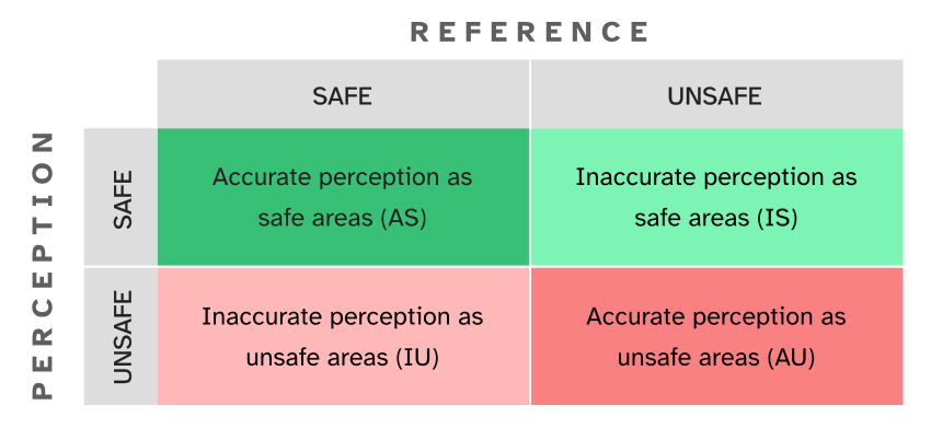
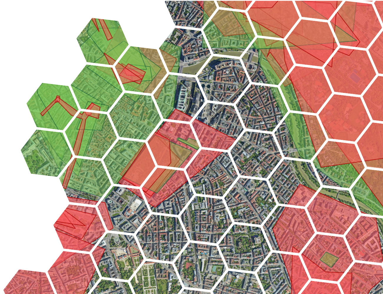
Understanding where and why the crime perception gap is more significant can help take actions to narrow this gap. This is important because spatial crime perceptual gaps can impact various aspects in people's lives. They can affect the resident's quality of life, alter social behavior, and influence spatial dynamics. For example, perceiving a safe place as an unsafe place can lead to avoidance behavior and needless anxiety, while perceiving an unsafe place as safe could potentially increase the risk of victimization. Therefore, it is essential to detect the gaps in space, identify the residents' routes, and afterwards implement actions that increase the accurate awareness of safety levels in the city.
This project invites public collaboration through a geo-questionnaire, a type of survey that consists of two main tasks: first, a mapping activity where participants mark objects or features on a map using spatial entities such as points, lines, or polygons; and second, a follow-up questionnaire to gather additional insights about the mapped features through open-ended or multiple-choice questions.
The collected responses are then aggregated to identify a "collective truth"—the value of combining diverse perspectives (Brown & Pullar, 2012). This process helps to create a more comprehensive understanding of crime perception by compiling individual insights.
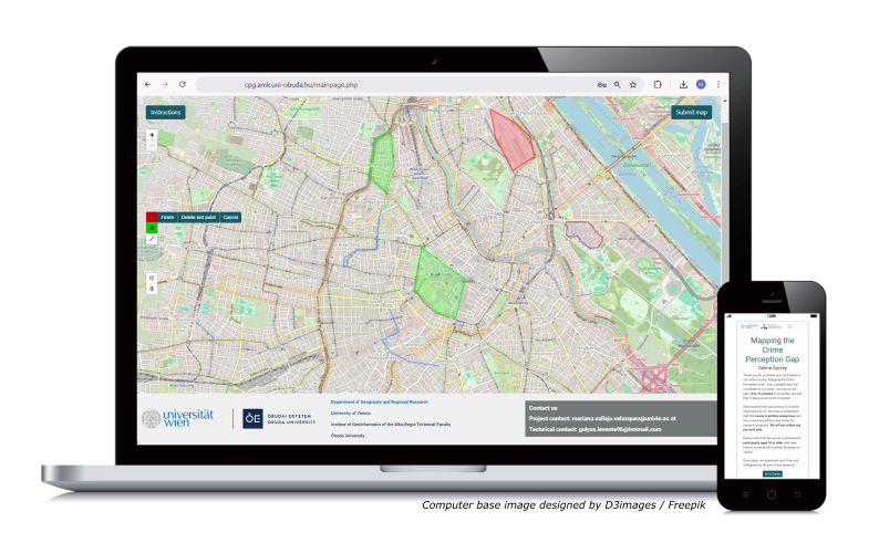
As part of this project, a web-based geo-questionnaire was conducted to capture crime perception in Vienna and Budapest. The survey, available in Hungarian, German, and English, targeted residents aged 18 or older and was open from November 27, 2023, to February 20, 2024.
Participants were asked to mark areas where they feel safe or unsafe on a map and provide additional details through follow-up questions. They also had the option to draw their daily activity routes. The second part of the survey included general safety-related and demographic questions.
The survey was distributed via university networks, social media, and on-campus materials, resulting in 533 responses from Budapest and 123 from Vienna.
Advances in Quantitative Methods Panel 2: Spatial and Geographic Modeling in Criminology
3-6 September 2025, Athens
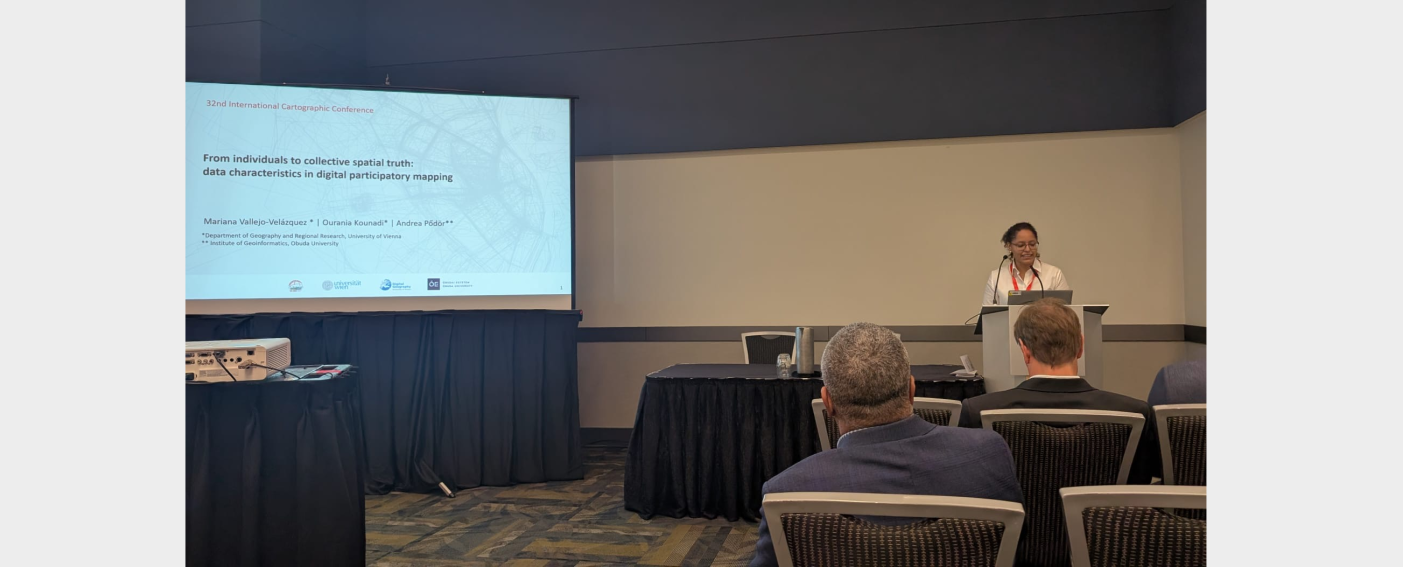
From individuals to collective spatial truth: data characteristics in digital participatory mapping.
17-22 August 2025, Vancouver

Joint event of the Hungarian Science Festival 2024
14 November 2024, Székesfehérvár, Hungary

Criminology goes East
11-14 September 2024, Bucharest
24 July 2024, Budapest
Geographic Information Science for a Sustainable Future
4-7 June 2024, Glasglow
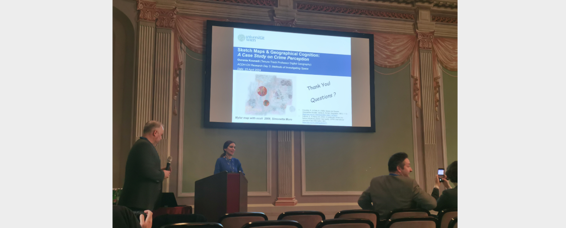
Austrian Centre for Digital Humanities & Cultural Heritage
23 April 2024, Vienna
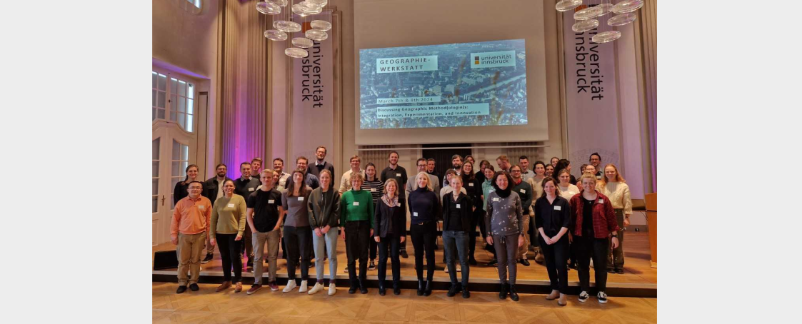
Discussing Geographic Method(ologie)s: Integration, Experimentation, and Innovation
7-8 March 2024, University of Innsbruck
Here you can find some scientific references:

Principal Investigator | Austria
Department of Geography and Regional Research
University of Vienna
ourania.kounadi@univie.ac.at
Academic Profile
Principal Investigator | Hungary
The Institue of Geoinformatics of the Alba Regia Technical Faculty
Óbuda University
podor.andrea@amk.uni-obuda.hu
Academic Profile
Researcher
Department of Geography and Regional Research
University of Vienna
mariana.vallejo.velazquez@univie.ac.at

Researcher
Department of Geography and Regional Research
University of Vienna
qileih66@univie.ac.at

Geoinformatics Developer
The Institue of Geoinformatics of the Alba Regia Technical Faculty
Óbuda University
gulyas.levente96@hotmail.com

Project Assistant
Department of Geography and Regional Research
University of Vienna
alexander.bressler@univie.ac.at

Project Assistant
Department of Geography and Regional Research
University of Vienna


Project no. 143448 has been implemented with the support provided by the Ministry of Culture and Innovation of Hungary from the National Research, Development and Innovation Fund, financed under the ANN_22 funding scheme.
This research was also supported by the Austrian Science Fund (FWF) [grant DOI: 10.55776/I6274].